Special Geological Maps
Various different geological and tectonic maps at scales from 1:25,000 to 1:100,000 supplement the information given in the Geological Atlas of Switzerland and the Geological Map 1:500 000.
Printed maps
Geological and tectonic special maps ranging from 1:25,000 to 1:100,000 scale complement the Geological Atlas and GeoMaps 500. They cover areas chosen for geographical or thematic reasons and give information on regional geological relationships or focus on selected topics of special interest.
Further information
Search in the list:
14 products

- Author: G. Frischknecht, H. Jenny & J. Kopp
-
Description:
G. Frischknecht, H. Jenny & J. Kopp: Geologische Karte der Adula, 1:50000, 1923 (Vierfarben-Reproduktion 1998, auf Spezialpapier). - Erläuterungen vergriffen.

- Author: H. Preiswerk, L. Bossard, O. Grütter, P. Niggli, E. Kündig & E. Ambühl
-
Description:
H. Preiswerk, L. Bossard, O. Grütter, P. Niggli, E. Kündig & E. Ambühl: Geologische Karte der Tessineralpen zwischen Maggia- und Blenio-Tal / Carta geologica delle Alpi ticinesi fra Valle Maggia e Val Blenio, 1:50000 (Legende deutsch und italienisch), 193

- Author: J. Oberholzer † (Bearb.)
-
Description:
J. Oberholzer † (Bearb.): Geologische Karte des Kantons Glarus, 1:50000, 1942 (Vierfarben-Reproduktion 1984, auf Syntosil). - Ohne Erläuterungen.

- Author: A. Isler, F. Pasquier & M. Huber (Bearb.)
-
Description:
A. Isler, F. Pasquier & M. Huber (Bearb.): Geologische Karte der zentralen Nordschweiz, 1:100000 (mit angrenzenden Gebieten von Baden-Württemberg). Herausgegeben gemeinsam mit der NAGRA, 1984.

- Author: W. H. Müller, M. Huber, A. Isler & P. Kleboth
-
Description:
Erläuterungen zur geologischen Karte der zentralen Nordschweiz (Spezialkarte Nr. 121), von W. H. Müller, M. Huber, A. Isler & P. Kleboth, 1984.

- Author: R. Dössegger (Bearb.)
-
Description:
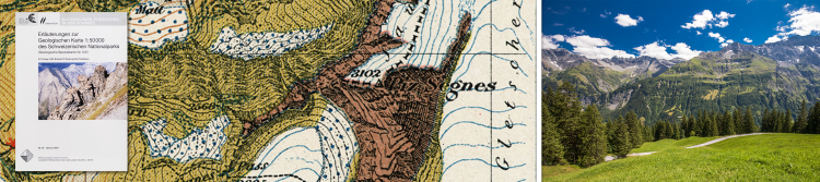
R. Dössegger (Bearb.): Geologische Karte des Schweizerischen Nationalparks, 1:50000. Herausgegeben gemeinsam mit der Kommission für wissenschaftliche Erforschung des Nationalparks, 1987.

- Author: R. Trümpy, S. M. Schmid, P. Conti & N. Froitzheim
-
Description:
Erläuterungen zur geologische Karte des Schweizerischen Nationalparks (Spezialkarte Nr. 122), von R. Trümpy, S. M. Schmid, P. Conti & N. Froitzheim, 1997, ISBN 3-906723-12-7.

- Author: A. Steck, B. Bigioggero, G. V. Dal Piaz, A. Escher, G. Martinotti, H. Masson
-
Description:
A. Steck, B. Bigioggero, G. V. Dal Piaz, A. Escher, G. Martinotti, H. Masson (1999): Carte tectonique des Alpes de Suisse occidentale et des régions avoisinantes, 1:100000, ISBN 3-906723-15-1. Explanatory booklet by Albrecht Steck, Jean-Luc Epard, Arthur Escher, Yves Gouffon et Henri Masson (2001).

- Author: M. Donzeau, R. Wernli, J. Charollais & G. Monjuvent
-
Description:
M. Donzeau, R. Wernli, J. Charollais & G. Monjuvent: Saint-Julien-en-Genevois, 1:50000. Publiée avec le Bureau de Recherches Géologiques et Minières, 1997, ISBN 3-906723-17-8. - Notice explicative par M. Donzeau, R. Wernli, J. Charollais & G. Monjuvent, 1

- Author: Y. Kerrien, C. Turrel, G. Monjuvent, J. Charollais, A. Lombard, F. Balmer, F. Olmari, R. Papillon, L. Fontannaz, G. Amberger, C. Ruchat, Y. Grebert & M. Marthaler
-
Description:
Y. Kerrien, C. Turrel, G. Monjuvent, J. Charollais, A. Lombard, F. Balmer, F. Olmari, R. Papillon, L. Fontannaz, G. Amberger, C. Ruchat, Y. Grebert & M. Marthaler: Annemasse, 1:50000. Publiée avec le Bureau de Recherches Géologiques et Minières, 1998, ISB

- Author: R. Plancherel, C. Caron & P. Broquet
-
Description:
R. Plancherel, C. Caron & P. Broquet: Samoëns - Pas-de-Morgins, 1:50000. Publiée avec le Bureau de Recherches Géologiques et Minières, 1998, ISBN 3-906723-26-7. - Notice explicative par R. Plancherel, 1998, ISBN 3-906723-27-5.

- Author: A. Berger and I. Mercolli
- ISBN: 978-3-302-40016-7
-
Description:
A. Berger and I. Mercolli (2006): Tectonic and Petrographic Map of the Central Lepontine Alps, 1:100 000 (disponible aussi plano), ISBN 978-3-302-40008-2.- Explanatory notes by A. Berger, I. Mercolli and M. Engi, 2007, ISBN 978-3-302-40016-7.

- Author: O. A. Pfiffner, M. Burkhard, R. Hänni, A. Kammer, R. Klligflied, N. S. Mancktelow, J. W. Menkveld, J. G. Ramsay, S. M. Schmid & R. Zurbriggen
- ISBN: 978-3-302-40042-6
-
Description:
O. A . Pfiffner and al.: Structural Map of the Helvetic Zone of the Swiss Alps, including Vorarlberg (Austria) and Haute Savoie (France), 1:100000, 7 sheets.- Explanatory notes by O. A. Pfiffner. ISBN 978-3-302-40042-6

- Author: A. Berger, I. Mercolli, M. Herwegh and E. Gnos
- ISBN: 978-3-302-40093-8
- Edition: 2017
-
Description:
Geological Map of the Aar Massif, Tavetsch and Gotthard Nappes, 1:100 000. - Explanatory notes by A. Berger, I. Mercolli, M. Herwegh and E. Gnos.
"" added to basket
Go to the basket